12.10.2026
Attention
Major change in the weather expected on Wednesday
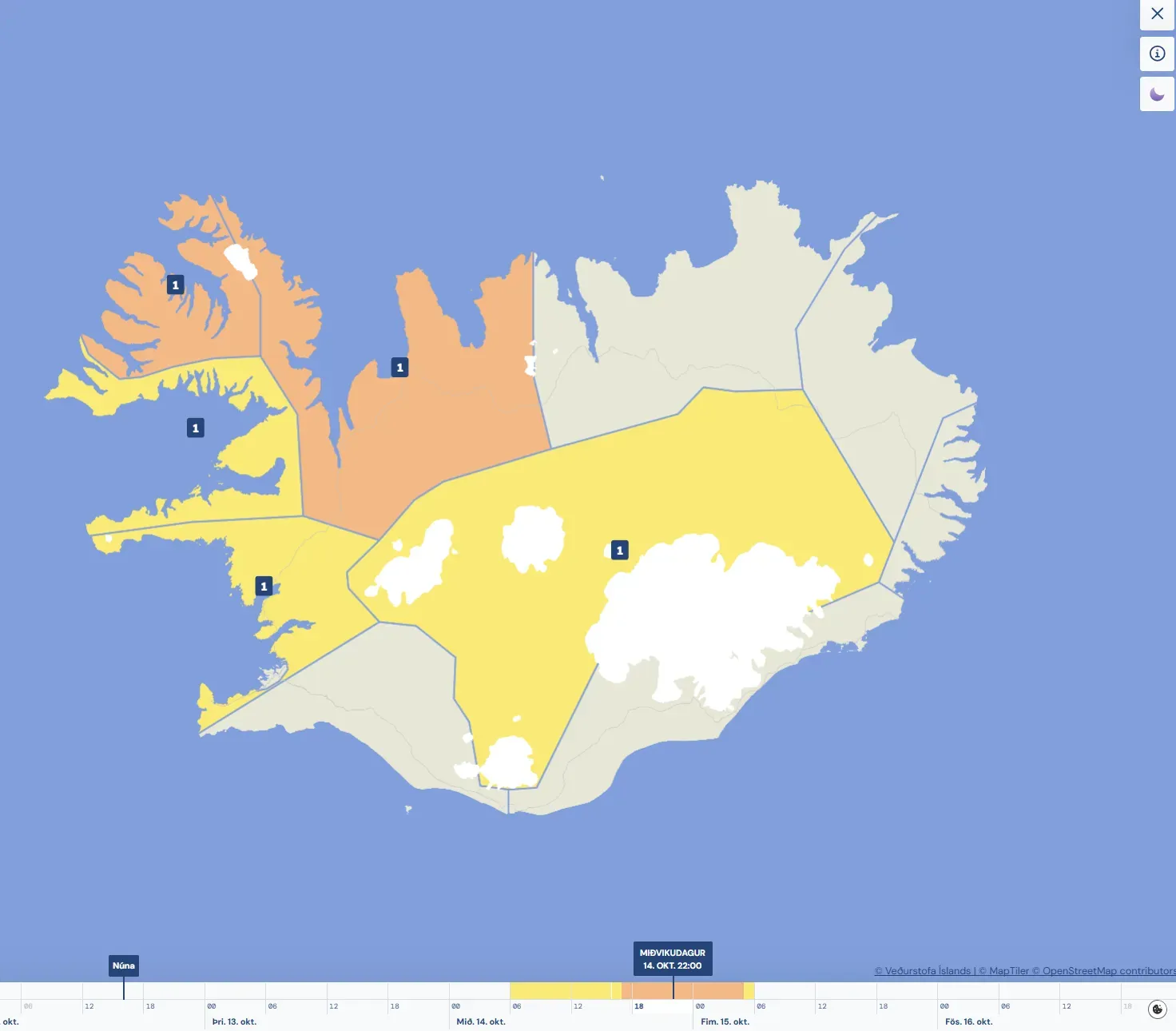
On the weather warnings page, you can move the time slider to see which warnings are in effect at different times.
Today has brought fresh to strong southerly breezes with showers. In the northeastern part of the country, however, skies cleared, bringing sunny and pleasant weather after last night’s frontal system moved north of Iceland. At the time of writing, today’s highest recorded temperatures are 13.6°C in Neskaupstaður and 13.5°C in Eskifjörður.
Calm weather is forecast for tomorrow, with light southerly or variable winds and occasional rain. Once again, the northeast stands out with dry weather, although some places in that region may see rain tomorrow evening.
Strong gales and blizzard conditions forecast for Wednesday
Forecasts indicate a major change in the weather on Wednesday, when a very deep and compact low-pressure system is expected to cross Iceland. During the first part of the day, easterly and northeasterly gales or strong gales are expected, with considerable or heavy rain in lowland areas across most regions, but sleet or snow in the mountains. On Wednesday afternoon, the centre of the low is expected to move over eastern Iceland, bringing a deceptive calm, with light winds near the centre. To the west of the centre, however, a band of northerly winds is expected to reach strong gale force. These northerly winds will bring colder air from the north, and towards evening and during Wednesday evening, the snow line is expected to fall to near sea level in the Westfjords and Northwest Iceland. Where snowfall coincides with strong gales, blizzard conditions are expected. Orange warnings have therefore been issued for the areas in these regions expected to experience the most severe weather. Warnings in other regions are yellow.
The forecast is sensitive to changes in the track of the low
Forecasts for this type of severe weather, when the centre of a low crosses the country with strong gales in one region and light winds in another, are particularly sensitive to changes in the track of the low’s centre. New model forecasts reach the Icelandic Meteorological Office’s forecasting team several times a day. These are reviewed, and warnings are updated if necessary.
Conditions expected to ease on Thursday
The low-pressure system is forecast to move rapidly across Iceland and be situated northeast of the country by Thursday morning. Strong northwesterly winds with snowfall are still expected in North and East Iceland at that time. The low is then expected to continue moving rapidly northeastwards and should have moved away by Thursday afternoon, leaving cold but reasonably settled weather across the country.