BETA
15.09.2026
Heavy rainfall tomorrow
- Heavy rain is expected in many parts of Iceland.
- The rain will move from west to east and will be in the Eastfjords in the afternoon.
- Caution is advised when travelling due to the possibility of rockfalls and increased sediment transport in streams and rivers.
Tomorrow, Wednesday 16 September, a low-pressure system will move across Iceland from west to east, bringing heavy rainfall over a short period. The heaviest rainfall is expected in the southern Westfjords, Barðaströnd, Reykhólasveit, Snæfellsnes, South Iceland, Southeast Iceland and the Eastfjords.
The precipitation will mostly fall as rain. It will begin overnight on Wednesday in western Iceland and then move eastwards across the country. The heaviest rainfall in the Eastfjords is expected tomorrow afternoon.
Autumn low-pressure systems of this kind are not unusual at this time of year, but considerable rainfall and high precipitation intensity may occur over a short period. Under such conditions, surface movements such as rockfalls cannot be ruled out, as well as increased sediment transport in streams and rivers.
As roads often run beneath steep slopes, travellers are advised to exercise caution and monitor information from the Icelandic Road and Coastal Administration.
The Icelandic Meteorological Office welcomes reports of landslides. During switchboard opening hours, reports can be made by phone at 522-6000 (contact information), or by email to skriduvakt@vedur.is. It is helpful to include a photograph of the event (landslide or rockfall), the exact location, and the time when the event occurred or was observed. Landslides and other avalanches can also be reported using this form.
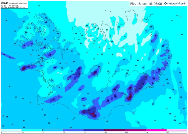
Accumulated precipitation over the next 72 hours, according to the IG weather model.